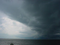


(after a stormy early evening, the Space Coast was treated to a fiery sunset)
Boy, they don't make it much more stable in the atmosphere at this time of year around here as this morning is. It appears there is a light drainage flow down the peninsula characterized by almost nil flow or very light land breeze on both coasts, with a temperature of nearly 75 degrees in Cape Canaveral which is cool by standards of late (by a mere 3 degrees). Morning Cape sounding has an unbreakable cap strength of 4.0 (very strong) and near calm winds the whole way up. Don't expect this to last all day, but it should be indicative of what the first half of the day will bring.
Additionally to the above mentioned, we have some high clouds in the vicinity, but they appear by poking my head out the door that they are mostly along the immediate coast. In any case, with it being so stable right now I'm having a hard time envisioning coastal showers to form in the late morning...so all in all it looks like it will be a perfect beach day until at least 4pm if not later.
Don't think there will be a sea-breeze collision today between the coasts for a number of reasons:
1) differential heating between land/sea is not nearly as great as the early summer when ocean temperatures are much cooler, hence giving them that extra nudge. Expect any sea-breeze to linger within 10-20 miles of either coast with light and variable winds inland most of the day
2) lack of winds aloft won't aid in frictional drag with the lowest atmospheric levels to steer the winds in any particular direction
Thus, expect a very stagnant and probably uncomfortable day inland, with the coasts feeling some relief by noon time.
There does appear to be a remnant mid-level low pressure 'bubble' off the NE coast of Flagler county that was there yesterday in association with the weak stationary boundary that was over the state. From all appearances at this time though, it appears what was left of the boundary has all but completely vaporized into a mere shadow of what it was before (which was a mere shadow!). Hence, without any upper or mid level triggers expect shower/storm activity to be mainly land mass generated around the lakes, Tampa Bay, and "hot pockets" with any motion to be dictated by probably some healthy outflow boundaries after 6pm if one, or a cluster of small ones, can get going. With that a possibility, boundary collisions could generate more storms although not expecting a broad coverage of them.
Be noted that most of the models are indicating a good chance of showers/storms today, so I kind of went "off the norm" this morning to take a wag at the flip side of the coin. It also doesn't mean it can't rain on your head today. Just consider yourself one of the lucky few who get to experience it today :-).

No comments:
Post a Comment