WEATHER MADE CLEAR FOR ALL TO HEAR

"But seeing they could not See; hearing they could not Hear"
“The views expressed herein are those of the author and do not necessarily represent those of the National Weather Service or affiliate/related organizations. Please consult .gov sites for official information”

"From its chamber comes the whirlwind, and cold from the scattering winds." - Job 37:9.

"The wind blows to the south and turns to the north; round and round it goes, ever returning on its course".

Sunday, June 2, 2013

Pattern Change! - "Pandora's Box of Adverse Weather Watches" Later in the Week?

PATTERN CHANGE COMMENCED LATE SATURDAY OVER MUCH OF FLORIDA. See notes above.

TODAY: The last post was Saturday a week ago which referenced the chance for a prolonged period of easterly winds, after a severe thunderstorm warning on the prior Thursday and then a rocket launch on Friday. On shore winds with periods of showers (mainly South Central and South Florida and toward the west side of the state (most notably yesterday) was the rule for several days. That pattern began to break down late Saturday and continues to break down as this is being typed. Note the light wind this morning.

High pressure to the east of the state is retreating to the east as a frontal boundary (which resulted in the Oklahoma City tornado traffic fiasco the other day, see images at end of post) progresses east but will never clear Florida.  Meanwhile, a broad and somewhat disorganized area of low pressure is to organize slowly over the next 48 hours in the Bay of Campeche with somewhat of a mid-level 'like' inverted trough to become more developed across the Central Florida region as noted above heading into Wednesday. (surface features will be a bit different). Now that we are caught up to the current time:

SUNDAY-TUESDAY: The short of all of this for today through Tuesday:  Better chances of thunderstorms as opposed to rain showers from early-mid afternoon, possibly lingering to well after dark as they decay after sunset. Steering currents today are already on the shift from west to east but very light and will unlikely be able to combat the east coast sea breeze, at least until early evening. Increasing moisture from the South could result in a number of showers and thunderstorms (mainly away from the immediate coast) although thunder might be audible from there. More likely some showers might be able to go up along the east coast sea breeze as it develops toward noon and onward making slow westward progress before meeting up with similar conditions from the west by mid-late afternoon over the interior. With a slow eastward push aloft, some of this activity might be able to make it to the immediate east coast just about anywhere along the Florida east coast by evening (or earlier toward South Florida) as the east coast sea breeze retreats back to the east coast.  Do note  that invariably each day will vary from one to the next so the "Day by Day" forecast blog post rule will apply through the week. Severe storms are not expected although a Special Weather Statement or two might become necessary for some stronger wind gusts and possibly some local flood statements due to slow storm motion and accumulating resultant rainfall.  

WEDNESDAY-FRIDAY: This is the most potentially volatile period as it stands this morning for a variety of reason which will only be briefly spelled out this morning due to the 'yet to develop' situation that has been captured by virtually all the forecast models in some form or another.

For today, I'm discounting the Canadian Model which shows a strong tropical storm moving into the Florida Big Bend later in the week.

Although, the 2AM (EDT) GFS is showing a Sub-tropical depression like low pressure area moving across the I-4 (which will be noted in imagery below).  The overall consensus though is for not one but two main areas of low pressure to cross the state from Central to North Central Florida from sometime overnight Wednesday toward Friday (with possibly smaller imbedded impulses as well). Timing might never be pegged down exactly but we'll spell out a few things that have been fairly consistent, then from that point we will be able to see how well our forecast models end up verifying in the coming days ahead.
===================================================================
1. A sub-tropical like low or series of lows (Perhaps a depression) will eject ENE-NE from near the NW tip of the Yucatan Peninsula toward Florida, highlighted and finalized by a more organized one at which point the 'show will be over'. It is the earlier stages of development of that final 'low' that is of most concern regarding a window of opportunity for brief tornadic/mini-supercell 'spin ups'. So far that window has been showing up from SW-W Florida and extending eastward and NE around the Wednesday-Wednesday night time frame into Thursday. Images below :

PRELIMINARY HEADS UP JUST IN CASE: The red box would be perhaps a tornado watch area with Flood watches as well being hoisted on the late Wednesday time frame. The lower left image is a depiction of the curvature of winds with height. Large looping hodographs would favor the tornado potential  which at this point is indicated by the red box above with other notes. Although that hodograph is not 'large' it is looped and it does get more 'interesting' toward a portion of South Central to the Beach line zone later in the period.

2. The more interesting thing that might be a fly-in-the-ointment is just exactly what if anything might develop as the upper level energy cross the Loop Current in the Eastern Gulf. The latest GFS is actually forming a weakly closed sub-tropical like Low pressure with winds of Tropical Depression to minimal Storm strength  Regardless of whether the system is named or not appears so far to be irrelevant unless we are in for a big surprise the next 72 hours. The fact remains that the GFS model has been showing this 'tornado' or strong wind gusts in mini-supercells (rotating thunderstorms) for quite a few days in a row now.

From the period of Early Thursday through Friday a "Pandora's Surprise Cache-Cash Award of Watch Boxes" might be in the making for accumulating rainfall of up to (dare we say 8 plus inches?) toward I-4? Do note, the Climate Prediction Center was highlighting South Florida just the other day for highest rainfall, but it contradicted another link on the same page that was showing further north (from what I could tell). The red area is of 'Overall " biggest interest as of this Sunday Morning for   tornado potential although all of the state mainly south of  I-10 will be in the cards of something interesting at varying times from late Wednesday into Early Friday.

3. To up the ante on a storm track which is shown by the black line above along that dashed line shown in the first image, the latest ECMWF model is finally available on this computer as of 4:40 AM Sunday morning. Noting that although this model is amped as the most reliable time and time again, it initially was taking a low into Louisiana  whereas the GFS has never once implied such a track.

LATEST ECMWF GUIDANCE SHOWS TWO VORTICITY CENTERS (with another lingering in the Gulf)

The greatest tornado threat (if there is to be one) would NOT be under those lows but South and ahead of them..particularly as the first one moves in. The GFS and even the ECMWF have been 'implying' somewhat of warm front/cold front trough like system associated with the first low. It is along and preceding a pseudo-like warm front lifts northward from the Keys toward I-4 into Thursday-late Thursday  time frame so far that is most interest regarding that feature (which was reflected in the early image showing the hodograph).
So far, the biggest risk area begins toward SW Florida/Keys which lifts NE'tward to East Central Florida slowly with time.


4. GFS rainfall totals directly associated with those little 'vorticity maxes' have been tracking rainfall over a 24-48 hour time from of up to 8" (at least) for quite some time now generally along I-4 toward North Brevard County although there was a time when the track was across South Florida. Will this all change once again?  Quite possibly, although the time is drawing nigh and not once has the ECMWF tracked a disturbance across South Florida.

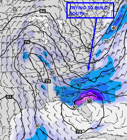
BEYOND: The system should be clipping the outer Carolinas just in time for another front and upper level trough which was shown in the very first image in this post to be pressing east. This will continue to keep the Atlantic High Pressure ridge axis suppressed across South to South Central Florida placing the state in a late afternoon thunderstorm / "Welcome Summer?"  Wet Regime like pattern up through the 12th of June which is a bit early, favoring the east side of the state for late afternoon thunderstorm activity.  

OTHERWISE: Discussions from a wide variety of forecast outlets are looking for an active tropical season. I'm watching the Northern Gulf and Florida particularly this year, not that it matters..but this area is long over-due climatologically speaking, especially South Florida (Miami/Dade) area for a "Big Named Storm".

TWITTER "TWEETS" regarding the other day in the Oklahoma City area  as the "High Speed Dirt"  flew not only along the ground but across the wires and the wireless.


No comments:

Saturday, May 25, 2013

Breezy This Afternoon, Drier and Mild Especially Beach Side

According to the NWS a wind surge came in toward Daytona earlier, this surge might reach the beaches of Brevard before noon time and then 'mix out'. Otherwise, very nice weather throughout the weekend and a bit cooler

 NOTE: The GFS (Global Forecast System Numerical Weather Forecasting model) is again bringing back a tropical system toward Florida the first week of June. HOwever, it has been doing this for nearly a week now only off and on in an inconsistent fashion, at this point it holds little to zero credibility although the timing is impeccable.


Delta Launch Last Night As Viewed From Cape Canaveral 

This Severe Warned Storm as it appeared looking west on the 528 West of Canaveral and East of Merritt Island, Florida on Thursday


The Storm Started to take on a
"Flying Eagle" Appearance


No comments:

Thursday, May 23, 2013

"Could" Be a Storm (s), May Be Strong, East Half of State Today

Changes are in the making. After reviewing forecast discussions, morning soundings from early today were not really favorable per them for storms today except toward South Florida, but suspect some changes might be in the making as I write since that time. Water vapor imagery is showing deeper moisture working into North Central which which also reach south Florida later today accompanied by potential outflows from the North If and only if storms manifest toward East Central Florida ..on the other hand....

TODAY: A solid waterspout was noted by the Keys yesterday, as were some funnel clouds reports into Central and South Florida due to the near calm winds throughout the column or depths of the atmosphere (particularly South Florida) . That particular air mass has shifted out but may also be being replaced by one of more continental nature . In short, there is some rapid recycling of the airmass over Florida today best I can tell of a new nature. Morning  soundings might have been taken at just the 'wrong' time to detect the change (hard to say from an amateur's arm chair). Regardless, this would be a heads up post (just in case). 

With that said, chance of some storms, possibly strong moving in from the NW to NNW if not North (in from the coast) working south along the east coast sea breeze later today. Some of these could be strong especially if the can work off shore from near Cape Canaveral and South to South Florida or if one can latch on to the sea breeze front and 'work on it' heading southbound west of US1,.and along the south and east sides of Lake Okeechobee in toward Palm Beach, Martin, and St Lucie Counties.

Activity will end shortly near or after dark most areas.

BEYOND: Things appear at this rate to get   quiet for a while after today for the most part. Easterly wind will ensure in the next days which will also be a bit drier making for slightly cooler east side temperatures and holding more steady over night. Pretty much near normal. It appears this could be the case for the remainder of the month as well.

1 comment:

Sunday, May 12, 2013

Chance of Iso-Strong/Severe Thunder Southeast Quadrant

Severe Warned Storm -Cape Canaveral, Hail in Some Locations Non-Severe,
near Severe Wind Gusts Reported

Above Image superimposed (left) with a severe warned thunderstorm on Saturday. 
AT 447 PM EDT...NATIONAL WEATHER SERVICE METEOROLOGISTS DETECTED A  SEVERE STORM CAPABLE OF PRODUCING DAMAGING WINDS IN EXCESS OF 60 MPH.THIS STORM WAS LOCATED NEAR ROCKLEDGE AND MOVING NE AT 15 MPH.  
  
* OTHER LOCATIONS IN THE WARNING INCLUDE...BUT ARE NOT LIMITED TO...  MERRITT ISLAND..
.COCOA BEACH...CAPE CANAVERAL...JETTY PARK AND PORT   CANAVERAL 


TODAY: Another chance of isolated thunder (iso-thunder) over the SE portions of the state, mainly from near Titusville or Cape Canaveral south to near MIA or FLL (Fort Lauderdale) mostly nearer the east 1/2 of the state.

There are   issues today with down draft CAPE  once again which could limit to some degree large storms, but those same factors (if they get going) could make them popcorn severe. So far, most to all locations near and north of I-4 appear to be completely out of the picture today. The irony is that it is that location where the better wind fields are that would support severe storms, but those to work their way toward the Magical Central Dividing Line running from the Port of Canaveral toward North Tampa Bay. Timing is another issue as well, as outflows, if activity from further south manifest, could advect favorable 'storm air' toward the North Brevard Beaches with an intersect over "Badges Only" no-man's land Space Center. I sent a badge request in last year to gain access to those secure areas but I guess they didn't buy it.

Surface based instability is higher than latest GFS and NAM are showing per the Mesoscale Analysis Page, but lifted index is lacking toward The Beach Line but the trend has been to build that parameter north to MLB or Canaveral. Overall, it's another day of cat and mouse in wonder if , and,, or when the needed parameters will sync together after and during peak heating (number one), and number two, if the east coast sea breeze can get going north of Vero Beach. That is the key ingredient to get the pulse strong storms to activate, at least while they are over land.


Without the sea breeze north of Vero, the stronger storms if any appear will be limited toward Ft. Pierce around the Lake and Southward. In general though, believe the sea breeze will get going around 2pm if not sooner, so should see some showers begin to generate. The models were having problems even up to the latest runs as what appeared to be convective feedback from yesterday's and last nights departing anomaly (which activated storms along the east coast from the Cape and South)  which could have thrown guidance out of whack. In general, the better chances of strong appear to be from near Sebastian Inlet and south at least as of this hour.

Hazards today near the storms would be lightning and wind gusts toward severe limits of 58 mph  with hail the better chance toward Lake Okeechobee and South Florida in general from near Vero Beach south to West Palm and inland a way. Note: The GFS favors most of Brevard, but as of this hour that potential is yet to be seen.  

MONDAY and BEYOND: Chance of thunder again mainly far South Central and South Florida nearer the east coast once again. Outside of Moan-day, a bit cooler and dry (normal for this time of May) at least into next weekend as it appears now. There is a very definite trend the continental U.S. is falling into so far the past 2-3 weeks, all part of the reason why this has been one of the lowest count tornado years in decades.

Interesting side bar is that the GFS is showing a tropical storm or weak hurricane to approach Florida near Memorial Day weekend but take heed, the GFS showed almost the  exact same thing at this time of year, last year.

Manatee Park Madness - Cape Canaveral, Florida

No comments:

Saturday, May 11, 2013

Is there a Chance of Severe Storms Today? Conditional Risk?

RED Indicates to Renegade Remote Chance only as of 11AM Today for an increasing potential for Isolated Strong to Severe Storms today after 3:pm  - 8pm. Heads up post only. 
TODAY: This post for pre-clarification is in lieu of the norm while monitoring a possible unfolding situation so as not to cry wolf. Latest SPC Mesoscale Analysis (next image which is one of many available) is showing some parameters for Supercell Thunderstorms (and even a tornado?) close to the state as a Mesoscale Convective Vortex (that is what it appears to be) approaches the state from the W-WNW. Whether the most volatile parameters conducive for a very active day remain to the west or not is one question, and the next is if they are even valid. In comparing the time scale parameters using the 'back in time' tool, the current values now showing are much further east than previous model runs were depicting. If that trend continues, we might be hearing weather update forecasts coming out after 1pm today, Thus, only a heads up. The secondary option is that there will be a focus toward the East Coast from Daytona and South for storms rolling down the Sea breeze front where max convergence could occur, after 4:30pm or so.

Note the little red box for what this images is showing. In previous guidance plots, that supercell composite parameter noted by the blue traces was well to the west of the state, and the forecast of it was also well to the west of the state, yet, that above is the latest just out.
 Otherwise: It is noted that there is strong downdraft CAPE associated with the unstable parameters which would or could significantly stifle afternoon activity (as was the case yesterday) except over South Florida. Thus, nothing is or might not be as black and white as things might at first seem to be concerning today's forecast.

On one hand, there could be severe storms. On the other hand, if some dry air in the significant layer between the Lifted Condensation Level (LCL) and the Level of Free Convection (LFC) is really like as moisture starved as guidance is showing , there could be very little activity today or what does goes up could quickly wisp out.  BUT, any storm that can get going could be Strong to Severe today. Otherwise, warm and sunny through the morning and early - mid afternoon. Storms , if any otherwise, should occur after 4pm through to after sunset as late as 10pm (as lingering showers and/or cloud cover). Again, worst case forecast for today, a beach and outdoor activities one.

SUNDAY/MONDAY: Once again, a chance of rain showers and thunder on Sunday, more so only on Monday for Far South Florida. Temperatures cooler behind the frontal boundary most notably in the afternoon hours. After Monday, there is almost no chance of rain until at least next weekend or nearly so.

No comments:

Friday, May 10, 2013

Chance of an Isolated Pop Severe Thunder Today, Showers/Thunder through Sunday

Areas in Red are where there is a better potential for a storm to pulse severe briefly, especially north of Lake Okeechobee along the sea breeze and/or Lake Breeze and toward East Central after 5-6pm
TODAY: Early post so much could change, but guidance for the past few hours is fairly consistent so going ahead and sending out an early post to cover that potential for the time being. Convective Instability today (CAPE) is expected to reach between 2500-3000 this afternoon, especially toward East Central by late day. Activity further south might get started before this potential fully develops but breeze boundaries from both coasts could provide ample lower level upward forcing to generate some strong activity there. There was a briefly severe storm down toward Dade County yesterday.  

Further north, east coast sea breeze to get near at least I-95 into Eastern Orange/Osceola County, west of which temperatures could get toward 90F degrees today. The best instability at this early hour is actually moving up the east coast from the south over the ocean. The east coast sea breeze therefore could be potent later today, especially after 5:30pm or so as the Lifted Condensation Levels lower post-peaking heating hours. Air aloft will be quite cold enough for small to near severe sized hail (mainly away from the coasts), but wind gusts could be strong elsewhere in one or two storms all the way to the coast. Thus, we might hear some Special marine warnings being issued.  There would also be a chance for a renegade funnel cloud .  Thing to watch would be any storm that goes up along the sea breeze and works north or south along it, especially if this occurs over or very near the intracoastal just about anywhere. Some activity might eventually either work off the east coast later on in toward evening or upper level winds could spread a cloud deck to the coast for a cloudy sunset.

SATURDAY: Same locations could see a storm but further north as well toward I-4. So far, no sign they will have the potential to be as strong as today , but that could easily change. Warm again, mostly away from the beaches as the sea breeze sets in. Might be more moisture available in general for earlier onset of cumulus cloud fields to hold off the afternoon highs. In general, looks like another sea breeze activation day plus some lake breezes, mainly later on in the day.

SUNDAY:  A frontal boundary will be pressing down the state with most activity a bit earlier along that boundary toward I-4 or so, and a bit later as the boundary works south. Any better chance of thunder though on this day looks to be near the Beach Line  from Titusville to Tampa and South, especially into South Central and parts of South Florida.

BEYOND:   Dry and nice for several days to come with some thunder over South Florida on Monday. It might still remain quite warm on Monday inland, South Florida (again) but a bit cooler further north with highs in the lower 80Fs to near 80F at the beaches.

No comments:

Saturday, May 4, 2013

Remote Chance of Showers North Central (Eastern) , Maybe a Fluke Thunder

Image shows two lows. The larger synoptic scale low is over Florida, whereas that smaller swirl in the Gulf is progressing toward the east to east south east. Conditional Chances for noted thunder activity are very low,
but the potential does exist.

TODAY: Latest elemental forces at play for Florida as far as rain chances are concerned are waning with what appears will be the last chance of rains for quite some time to come. Latest guidance does indicate sufficient instability despite cloud cover for some storms today but lack of any boundaries for low level convergence is a big down play. What effect if any the swirl in the Eastern Gulf will have if it makes it across the state is unknown. Guidance is showing only showers but some low level parameters would support even a strong storm all things aside. The down play at this hour is clouds or rain cooled air further north where the best wind fields appear to exist and weaker wind fields where the best instability resides. Steering would be quite slow unless a single storm gets cranking and latches on to the upper level wind fields. The result if pour Lifted Indexes being coupled against strong downdraft Cape, which in many cases results in zero weather action.

Otherwise, strong winds late yesterday and last night occurred in Volusia County primarily with one gust at over 200 ft. reported at 67 knots while winds for instance at Port Canaveral were around 3 mph at the same time. All this due to a tight pressure gradient on the north side of the very same low now still in place as seen below.

Last night's short term model depiction
BEYOND: Winds becoming more westerly in the next couple of days with a few periods of increased cloud coverage as two moisture bands rotate around the much larger parent low which was near Arkansas. This low will drop south and east in the next two days making for strong winds from around 7000 feet overhead and higher up, but which as it appears now will pass unrealized at the ground but for cloud coverage at time making for cooler afternoon highs  and very cool mornings commencing tomorrow morning (Sunday) due in part to west winds as opposed to easterly mornings winds coming in off warmer waters.

Gradual warming noted first on Wednesday afternoon with only a slight chance of showers toward the St John's river valley Basin and perhaps a stray shower on the North side of the Lake Okeechobee shadow in St Lucie or Indian River County toward the coast.

Will be watching for increasing tropical moisture though as a vast sprawling high pressure area over the Atlantic could bring increasing tropical moisture into the state prior to next weekend and beyond which will begin to interact with the next cold front that will only very slowly approach the state after triggering rains and storms across parts of Texas and NNE-NE along the stretch of the front which might get hung up over the South Central Plains region. The next better chance of rains so far is not until sometime around Friday and Saturday when we  could see showers and thunder over the interior counties and near the Lake, but even that will depend on if high pressure in the mid levels gets centered over or near the state which would shut down that possibility.  

So far beginning Wednesday it looks fairly certain that near summer like weather could be in the making temperature and moisture wise or seemingly so for those near the beaches, with only afternoon highs and greater moisture being constrained for a time.

No comments:

Friday, May 3, 2013

Another "Guess Work" Day at Hand - Where Will It Rain (or Will It?)

Image shows a misolow near Titusville and another off shore Brevard .
Little movement with those features;
The west coast sea breeze is showing some slow progression.
Atmosphere is a bit unstable
especially over interior Central/South Central
TODAY: Another guess work day at hand . Latest hour showed west to NW winds at Titusville and stronger NE-E winds just to the north on the North End of the Cape. Just south of that area toward at least north Central to Central Brevard as a result might end up dry today contingent upon motion of those small scale features OR if they suddenly fall apart. Otherwise, dry air is over South Florida but more moisture might be working into the picture. Stronger Easterly winds Volusia County and north should last all day though with rain, some heavy continuing at least for a time.  The bigger question is what will occur south of the light green line shown above? For now, will not play in favor of South Florida too strongly, but this could change working into mid-afternoon with no problem. Interior South Central to Central seems the best likelihood of rain receipt today with some big totals possible due to slow storm motion. Thus, localized flooding again possible especially over grounds that have already become supersaturated. There have been some huge 3 day rainfall totals in the past few days, if not hourly rainfall totals across many parts of the state as noted in forecast office reports. Interestingly a tower gauge a couple hundred feet above ground level at the Space Center reported a gust of 67 Kts or over 70 mph not long ago, hard as it is to believe, on the north side of the misolow (reminiscent of how the no name storm of October 2011 ended up only with less intensity overall).

Vorticity in the Upper Levels Over Florida noted might occur yesterday. It's not really moving much though hence the comment of 'very little ADVECTION".
WIthout actual advection there is not much affect of it being present
 

There is a chance the area of North Brevard will remain dry slotted today, and even after that whether it rains tonight in that area will have to be left to be seen. On the other hand, things could change rapidly almost any given point in time. Based on the Lifted Condensation Level (LCL) and Level of Free Convection (LFC) being, at least shown as, at quite  low levels this hour, if accurate, would require very little to get rain showers going heading toward mid-afternoon. Again, with slow storm motions someone might end up with gallons. Time will tell.

SATURDAY-SUNDAY: Most of the better chances at least of rain end today. A slight chance of rain tomorrow might manifest mainly toward the east coast from Ft. Pierce and north later in the day outside of any remnant early morning activity. Sunday it appears now must might be quite pleasant (at least as of this hour).

BEYOND: Cooler mornings notable Sunday-Wednesday with slightly below afternoon highs through Tuesday. By Wednesday-Friday all will return to norm, with parts of the East Coast perhaps seeing some of their warmer days yet this season contingent upon how well the east coast sea breeze holds off. There is still a shot a better cloud coverage though sometime Monday and or Tuesday but after that it appears we'll be almost scott free for quite some time in regard to rainfall with partly cloudy skies..

No comments:

Thursday, May 2, 2013

Two Options - Two Forecasts - One Day (Florida)

OPTION 1
Shows Mesoscale Analysis of a 700mb low though weak, over Central
Florida this morning partly responsible for morning rains. The Main Low
remains back over Louisiana. Trough connect the two lows.
 That 'low' over Florida at 700mb is mainly only a manifestation, or part,
of the same Low over Louisiana
TODAY: Difficult forecast as two scenarios are being depicted that could unfold. Depending on which one (if either) does, completely changes who will get what, where, and when. 

OPTION 1:  Thunder storm trigger in SE Gulf Moves into  SW Florida and advects toward Lake Okeechobee while slowly lifting north. Cloud cover is pretty bad today, so although temperatures aloft are colder today, not sure how much that will matter in regard to stronger storms being able to generate under far less than 'stellar' conditions than would be otherwise. The red in the image above shows a best guess at this early hour for where some stronger storms could occur. Under this scenario rain showers, though sparse, could occur about anywhere but more likely impact north and east toward Dead Central East Coast late in the day much like yesterday, only several hours sooner. 

The image above 'notes' that the low over Louisiana is expected to open up and merge toward Arkansas while the energy associated with it could drop south in to the Gulf and then eject toward Florida on Friday. This is shown in the next image. 

Otherwise, if this Option 1 pans out, there is a good chance of rain toward Tampa, Lakeland, Haines City to Lake Okeechobee with some isolated stronger activity, but the main mode of operation will be light to moderate rains.

OPTION 2:


The other option is that the faux 700mb low pictured in the other image hangs tight over the state. That combined with high pressure building south down the East coast of the U.S. could put the squeeze on the moisture and slosh it across main all areas north and near I-4 as shown in the purple and red. Any thunder would be elevated as instability is close to none in that area.

Further South though: If the low hangs tight the forecast for Tampa and Lakeland zones goes from good chance of rain and thunder to suddenly very little to none. On the other hand, the chance for thunder as shown above toward Central could increase due to circulation around ' said assuming low' which would change steering currents lat in the day to being from the SW-WSW (but slow) over Central Florida as instability could increase after and during peak heating.  In this OPTION we'll also downplay the likelihood of any strong storms out there to the point they'd be isolated so that it's not worth mentioning. There is a chance someone today could end up with big rainfall totals in this scenario. 

FRIDAY: Another Very Sticky forecast


FRIDAY: In this image is the new mid-level low in Arkansas with a pseudo warm front like feature composed of a wind shift line and vorticity streamers impacting East Central from early morning throughout the entire day. This means a lot of rain up and down the east coast particularly toward Brevard County.  Also note the black "X"s. Those would be energy pockets from the old low over Louisiana moving east toward Florida. By early-mid afternoon both the east coast features at 850mb and those lobes of energy at a high atmospheric level from the west at 700mb shown over the Gulf could mish-mash over the state making for a slosh fest. Time will tell, but if so, could rain almost all day Friday or Saturday.

SATURDAY: Depending on timing , Saturday could again be a mostly rainy day for Central Florida and perhaps not so much South Florida. 

SUNDAY: Latest guidance indicates the show might end as soon as Sunday now, with only a slight chance of light rain or a shower later in the day toward the east coast. Another weak impulse to pass over around Monday could generate clouds and some light right, but other than that we can close the chapter on this storm system's impact on Florida. Next will be the cooler air. Not 'cold', just cooler.

No comments:

Wednesday, May 1, 2013

Chance of Strong/Brief Severe Storms South Florida and other Anomalies Through Sunday

3AM Infrared Enhanced Satellite Imagery shows an MCS likely powered by an MCV approaching the SW Florida Coast. Later in the post we'll see how things have changed in the past nearly 12 hours since this image was captured
 TODAY: Complex forecast for not only today but the next several days as an Omega Block is in the process of forming between a low now near Louisiana and another off the California Coast at the mid-upper levels. The low near Louisiana is expected to eventually lift into Arkansas with a mid-level warm front like trough extending SE across Florida (as referred to several posts ago) during the next few days. The surface reflection is now coming to fruition into the Gulf from the former via a Mesoscale Convective Vortex (vorticity complex) viz System that is slowly encroaching on the west coast. Much dilemma involved concerning cloud coverage and weak low level convergence for storm initiation in an otherwise moderately unstable environment that is spreading north to Dead Central. Effective Bulk Shear in the mid-upper levels might be enough to provide the lift necessary to get storms going coupled along cold air aloft and convergence from a rather weak sea breeze boundaries despite the cloud coverage combined over spreading all areas.  Thus, a chance of rain showers, some thunder, and some stronger thunder is possible over mainly South florida although as we head toward 2-3pm of peak heating and the aftereffects much can change, although the more northern extent for the most part should remain south of I-4 in regard to thunder other than perhaps an isolated event.

This shows best chances for Stronger Storms in red, thunder in orange, and rain showers (some heavy briefly) in the Green Bounds. Other isolated stronger storms are always possible just about anywhere though with in the thunder zone particularly up toward Polk County and perhaps even western Osceola County (for starters).
.Satellite Image shows the system later in the morning as it approaches Florida
This is the same view of the above image on radar.


THURSDAY-SUNDAY: Day by day forecasts will be the rule. In general terms, some rainfall totals are showing up from 1 1/2 - 5" mainly along the east coast south of I-4, and more specifically from the Cape and South with some outliers as far north as St Augustine getting into the mix. Exactly where heaviest totals will occur varies from model to model run, but the Cape area has shown up consistently until the latest morning GFS run to have the highest totals. Winds could increase along the east coast from Brevard County and north Mainly, and then become more ESE heading into later in the weakened. Another player to watch will be training rain storms and thunder ejecting off the Bahamas toward West Palm to Ft. Pierce come the weekend. Waterspouts might become a concern as well.  

The GFS is showing Saturday and Sunday to be particularly interesting over the east half of the state as drying moves in from the west with perhaps one more day of it on Monday afternoon. On the other hand, the last Euro Model continues the effects through Tuesday.

No comments:

Tuesday, April 30, 2013

Showers and Thunder Possible Again , Some Strong Most Likely South Florida

Post today has a big caveat namely for Central Florida. See verbiage in 'red'.
TODAY: Ample moisture is already in place today Central and South Florida. The issue with Central in regard to storms today is an outflow boundary seen on satellite animation which if 'post boundary conditions' hold to form, might stabilize the atmosphere too much for much activity to get going across Central Florida today. Not so much the case for South Florida though, at least not yet. The NAM shows very little activity today whereas the RAP and GFS are consistently indicating some rain. Suspect this might be convective feedback though. It appears the NAM might not have initialized well though on the other hand, which would make sense if the former is true.

Again though, the outflow boundary is a big question mark. On the other hand, looks like there will be good clearing for most areas prior to noon time allowing for quick heating with little chance of storms out over the Gulf stream causing high clouds to stream overhead as was the case yesterday. 

All things aside, with the worst rain-case scenario:

Chances of locally heavy rainfall and some minor street flooding, mainly inland and especially over areas that received a good dose yesterday (where over 2" was not all that uncommon). A few severe warnings were issued yesterday but actual severe was brief and rare. Temperatures aloft today though are equally as cold and wind shear per the SPC Mesoanalysis page is actually greater today, although looking around outside from East Central at this time it looks like a dreary day is in the making and that is about that. But, as can be seen in the image above, not all folks are cloudy.  Again, the bigger downplayer for a rain maker might be the outflow boundary seen in satellite animation. Will the lower levels recover in time? Chances are, it's still pretty early in the day, so it should be able to. Activity might get going just a bit later than previously expected but either way would expect that by 2-3pm showers and some thunder could get popping over at least the west 1/2 of the state and South Florida, earlier South Florida.

WEDNESDAY: Wednesday might be more cloudy than rain due to an expected MCS (Mesoscale Convective System) that might prop itself upstream well out in the Gulf sending high clouds this way. If not, that changes everything. We'll have to see on that one.

THURSDAY-SUNDAY: Chex Mixed Bag  to be determined. The GFS and to a smaller degree NAM suggestion strong onshore flow from a developing occluded system to the NW with a trough extending out and down across Florida. Pressure gradient winds of 20-G32mph, and rain rain rain from Brevard 'mainly' and south for Friday into Saturday primarily  but be advised,  guidance varies from model to model and from  run to run considerably. All guidance is indicating the Omega Block to set up, but the position of the low pressure system on the east side will  the prime determinant. It's simply too soon to know almost until it happens.


No comments:

Monday, April 29, 2013

"Could Get "Wild" in Select Locations Late Today, Rain in Forecast through the Week

Tricky forecast (no doubt) for today due to vast model discrepancies  This Cast is based on persistence and newly evolving short term guidance (in some cases)
TODAY: As mentioned yesterday, chance of strong to severe weather in random isolated fashion is possible later today remains with the greatest chances being over Central to North Central Florida with a slightly lower chance for the strongest activity over South Florida.  Given latest guidance trends and visible satellite imagery, the usual South Florida might get started earliest at a less than  'the most favorable time of day' for strongest activity, not to say there could not be some strong storms mostly west of I-95 toward the swamps.

Further north, at this time will be watching for an increasing S-SSE wind up the intercoastal to begin after 3-4pm time frame as the current very unfavorable conditions or rain in Central begin to shrink in size as moisture works into the area. At this time Central is not looking good for hardly a rain shower today, but that could quickly change after 4pm. Outside of model guidance, a more localized late day tilted sea breeze enhanced by gradient flow enhancing low level helicity and shear mainly near US1 toward I-95 combine with the land curvature of the Cape seems to be the best area for strongest activity ..with secondary areas further south and north. Thus, the area to watch late would be Osceola/Orange/ far eastern Lake County  most of Volusia County,  Southern  Flagler County (if high clouds do not affect that area) and North Brevard to South Central Brevard mainly west of US1. However, should a storm anywhere from Central Brevard north through Volusia effectively penetrate the sea breeze and violate 'model rules' a waterspout couldn't be entirely discounted near the water ways or off in the Atlantic.  The bigger threat as usual will be cloud to ground lightning strikes, some potentially far removed from the rain areas, small pea to dime hail, and wind gusts topping 60mph. Again, this would be after 4pm and closer toward the 6-7pm time frame; thus, a preliminary 'heads up and just in case'.

TUESDAY-WEDNESDAY: Not much has changed in the longer range for Florida, as noted yesterday, much is still 'up in the air' regarding what is to occur over the Central Plains toward the Mid West States regarding a mid-upper level low. To add fuel to the complexity of this 'more extended' time frame, guidance keeps going in and out with a mid level low (per previous ECMWF runs and at times the NAM) to form west of Florida as a function from the Northern Caribbean to cross FLorida and/or almost form over the state). On the other hand, the GFS has consistently not shown any such entity. If the latest ECMWF verifies, the rainiest time frame could be Thursday into Friday as a result of said anomaly  Another such anomaly is that the GFS is showing a bit of a mid-level 'warm front' wind shift type line across Central Florida on Wednesday (perhaps instead of that just stated) which could be a focal point for rain and thunder which could make almost anytime Tuesday into Wednesday the big rain day, especially along the east coast. Point is, every day is different than the previous as well as the day after as it stands now all of this week. 

Otherwise, temperatures will remain comfortable with plenty of clouds in the picture. Rain could occur on Tuesday just about any time through Thursday just to highlight that we could increasingly fall away from the after-evening type regime Florida is accustomed to. When all is said and done by the weekend some areas 'could' receive several inches of rain due to very slow storm motions, especially after today.

BEYOND: The prospects for much cooler air has also faded from the picture, come back, then disappeared again heading toward Sunday. Chances are, if it doesn't get here by Sunday, it never will.


No comments:

Sunday, April 28, 2013

Strong to Near Severe Storms (?) Monday, Active thru Wednesday/Unsettled Through Saturday

TODAY: Clouds with Sprinkles East Central toward the NW,
thunder possible west coast late
TODAY: Onshore flow continues becoming more ESE-SE-S into Monday. Although cloud cover exists mainly over Brevard County and inland a way, most of the state as can be seen from this above image remains quite pleasant. This was much the case as well on Saturday. Other than some sprinkles, not much going on today with a good breeze along the east coast which might sustain itself going into the over night for a time toward dark and onward along the Barriers.  Chance of thunder focus toward Tampa Bay late today and early this evening, with another shot possible up toward I-10 east of Tallahassee.

MONDAY: Flow becomes more southerly as Southern Branch jet right entrance region nose points toward Florida. Temperatures aloft quite unusually cold, although winds not strong aloft. Instability and lighter surface winds allowing for low level convergence and ample reactive outflow Lake and sea coupled with outflow from early day activity north Florida as well as over South Florida boundaries could result in some strong to near severe thunderstorms namely from marginally strong winds and/or hail, most likely in from the coasts toward Orange/Seminole, Western Volusia, and maybe interior north Osceola County. Activity could be strong as well, but if outflows come into play, it might end up being Central toward to after dark that gets the strongest storms. Activity could run late and into the post sunset hours and migrate off the east coast mainly from South Brevard  and north.

MONDAY image from the GFS. The NAM model is showing a more imposing proposition for
Monday over Northern Orange and western Volusia working toward most of Volusia and the north 1/2 of Brevard though. The GFS is more generalized, but thunder and/or rainshower chances are a pretty good bet most anywhere on Monday through late evening as they drift off the east coast.

TUESDAY-WEDNESDAY: Guidance currently indicates a 'bubble low' could form over South Central on Monday into Tuesday and move off the east coast by Tuesday night. Before then, another shot at strong thunder on Tuesday contingent on cloud cover. Activity could get started before noon time, with the best shot on Wednesday for any stronger activity appearing to be over parts of South Florida while rain showers and some thunder could still occur many other locations. Could also otherwise be cloudy. That is dependant on if that low does form placing North and Central in a more northerly wind flow, albeit temporary for about 24 hours.

THURSDAY-SATURDAY: Upper level low will be cutting off for a time somewhere around the Mississippi or Ohio River Valleys region resulting in more rains in those locations. Expect we might be hearing about river flooding downstream. The impact to Florida remains a bit uncertain, but it seems that at least the chance for stronger storms might have waned by then with cloud cover and or some rain showers in the calling, but exactly when, where, why, and how is still up for grabs as models , even since that last post a few days ago, remain in disagreement on where any cut off mid-upper low might form and how long it will last. One or two model runs even show no cut off at all, thus the forecast for really ALL OF NEXT WEEK is highly variable and quite open to reconstruction at any point in time. Just a heads up when or if watching weather on TV. At this point, the last chance for rain appears to be along the east coast south of I-4 later on Saturday.

BEYOND: If the low does close off, another impulse could approach the state in the good westerly flow aloft around Tuesday or Wednesday of the following week. Much remains highly (expressively so) uncertain.
The threat of much colder air temperatures on the ground though seems to have diminished from the previous GFS runs as suspected might end up being the case, although we could still see a good spread of 50Fs around Sunday morning.  Again, the latest GFS continues to show the cut off forming, with another impulse to form somewhere toward South Texas and head toward Florida the following 48-72 hours...which means nearly 9-10 days from today. How likely?...hard to say.

No comments:

Friday, April 26, 2013

Potential For Turbulently Wet to Eventually Quite Cool Beginning Monday or Tuesday

Areas Mainly East and South of the Orange Outlines Could Experience Very wet
conditions from a combination of Arctic like conditions mixing with some sub-tropical anomalies next week meaning very wet, cloudy, and eventually very cool conditions. Much is still TBD.
TODAY- SUNDAY: Pleasant weather for the most part prevails although there might be some increasing cloudiness for parts of Central and South Florida on Saturday into Sunday which would mean a bit cooler where clouds (if they manifest with a quick sprinkle) persist. Otherwise, not much to speak for as spring like weather prevails allowing the trees to manifest foliage and nature in general to blossom forth.

MONDAY-TUESDAY: The above image is the surface depiction for today with the highlight really being in the far NW corner. This is a surface reflection of what is to come well aloft at the jet stream level. Guidance is showing a deep upper level trough to drop into the country's midsection next week while in the meantime a southern branch sub-tropical jet will also be in place from west to east south of Florida. These two branches are expected as it now appears to meet up somewhere over the Deep South toward Florida. Cold air aloft, ample moisture, and unstable air would allow this pattern to become most evident going into Tuesday and more so on Wednesday.

WEDNESDAY- FRIDAY: Both the GFS and ECMWF (Euro) are showing unstable , wet, possibly stormy especially Tuesday - Wednesday time frame but continuing possibly through Thursday or early Friday. Exactly how the eventual outcome manifests will determine what kind of weather will occur heading toward late Wednesday (as it appear now). Guidance varies anywhere from a bit of a subtropical entity emerging from the Gulf and across Florida toward one of not subtropical origin forming over Georgia. If the former occurs weather could get quite windy along the east coast for a day or two with rain mixed in, preceded by a day or two of strong storms in the forecast. Either way, strong storms might end up being in the forecast from cold air aloft and some bulk shear in the upper levels Tuesday and/or Wednesday, or even Thursday.  In any case, under both circumstances, rain chances appear could occur almost any time after Tuesday or at least begin prior to noon time through late evening each day. Storm motions would be rather slow, so (or if so)..rainfall totals in small areas could end up being higher than model guidance is hinting at. On the other hand, what is showing as rainfall might actually end up being solely cloud cover.

BEYOND: Without going into greater detail (on the above), since much surmising leads to only more surprising, the GFS is hinting at unusually cool weather returning come next weekend with lows well into the 50Fs...accompanied by breezy conditions. Again though, the GFS has a tendency to go a little too far with low temperature forecasts in the long range for Florida at least, so will leave that up for grabs until a more reasonable time frame draws nigh.  The GFS has shifted gears nearly every 6 hours beyond 72-96 hours as it stands now (not unusual  but did eerily come into close agreement 12 hours ago with the latest Euro Model, which showed a surface low just off N. Brevard County come Thursday time frame after two days of decent rainfall chances.)Time will tell is about all that can be said at this point, at least for planning purposes.

Necessary Footnote  there has been hints of if not one but perhaps two blocking patterns setting up over the Northern Hemisphere in a run of the ECMWF model, and blocking patterns should one set up and just exactly where (being the next matter to consider) tend to be quite difficult from a future-cast perspective for forecast accuracy as we then are at the mercy of determining just exactly when any said block (or blocks) will actually break down. That is yet another factor to consider in an already what appears at this point to be a complicated, but yet to develop, situation.

This "Example" shows TWO Omega Blocks over the North Hemisphere with the United States at the ver y bottom of the image. The GFS hints at an Omega Block right over the United States in a few runs. Point being, wherever the block sets up, if one does, will be a big factor in the long range. The GFS implies one setting up toward the SE States as far north as Tennesse well toward 'next' weekend and beyond.
      

No comments:

Sunday, April 21, 2013

Thunder with Heavy Downpours (and Small Hail/Coastal waterspouts Central?) Into Mid-Evening

Explanation Required for image (see below)
As usual, forecast is privy to signficant faults, but will base this one on the previous post of a few days ago despite big model differences between that time and the current time. Over the past 36 hours guidaance indicated that in the previous post where it was alluded to that we could see more rains (Central) by sunrise Sunday, that this would no longer happen. However, guidance is now realigning with that previous thinking, thus, this post will remain with persistence of the previous suppostiion:

TODAY: The surface warm front of the other day is washing out over South Florida and is forecast to invert as shown above in Light Blue (as noted in previous post). This could become a focus with showers or even thunder, especially near the Coast Central and more inland South Florida.  The highest helicity and energy index late today into tonight at this point is forecast to exist across Central Florida at and just offshore the coast along the 2000 ft., slightly 'elevated warm front' which is really only a wind shift line. Further north at a higher atmospheric level is another wind shift line of pseudo-warm front nature at 5000 ft along which mostly rain fall will occur or simply considerable cloudiness.

Impulses aloft will begin to move in from the west and cause the pattern to 'buckle north' in response to their approach. Some will be quite weak, others stronger. Vertical velocities as high  up as 20,000 feet above a only slightly unstable air mass might occur as a result of the energy riding over aloft in a very cold aloft (unusually so), could (emphasis) result in heavy down pours, with a few model runs indicating between 1- 2.5" inches of rain fall coastal Brevard in particular to Southern Volusia County.  Most of these bigger totals, if it occurs, would be due to very slow storm motion if at all long the 2000 ft boundary shown above where there will be little steering. 

The highest instability is expected to remain offshore though (and South Florida), and there will be some steering from west to east. Thus, expect the heaviest activity, should it materialize to remain mainly just off shore. There could be a surprise strong wind gust or surge here or there after 11AM and/or into tonight should large activity send outflow back to the coast from off shore. Also, if conditions materialize such that mid level to low level lift is enhanced, a waterspout might not be out of the question along SE Florida and off Central coasts.

Will note that as of this time before sunrise, the Storm Prediction Center is watching South Florida (only) for strong storms today which very well could end up being the case; however, given the current conditions closely matching up with the NAM (reluctantly), the RAP. and  the HRRR model guidance, will trend in that direction. If the GFS verifies, all calls are OFF.

The implication being, that it is the 2000 ft  'wind shift front" that will be the active parameter going into late day and early evening which is forecast to lie directly across Central by late afternoon if not a bit sooner as the impulses ride in from the west., missing South Florida entirely by that time.  In short, strong storms are possible over much of South Florida although I am only showing a smaller area, and then along the east coast up toward Southern or Central Volusia within 5-10 miles of the immediate coast. Suspect most activity will remain off shore. Those parameters which could result in small hail and strong wind gusts Central might get made up for with heavy localized rainfall instead, should said 'worst case scenario' end up evolving. Off shore waterspouts might become a forecast issue as well for those in the 'know' at the offices.

IN SUM TOTAL: Chances of heavier rain and or storms possible mainly near the coast and off shore today from current time, and again mid morning, and then again late afternoon into mid-late evening.

MONDAY: Rain chances or cloud cover continues into Monday , but rain ends for the remainder of the week. Cloud cover might persist a bit longer.

The more notable warming trend to occur Tuesday or Wednesday with coastal tempered temperatures due to onshore wind off the slowing warming ocean waters, but quite pleasant through the remainder of the week after Monday. The next rain chance comes next weekend as it appears now, but it is way too soon to say with any degree of certainty.

No comments: