WEATHER MADE CLEAR FOR ALL TO HEAR

"But seeing they could not See; hearing they could not Hear"
“The views expressed herein are those of the author and do not necessarily represent those of the National Weather Service or affiliate/related organizations. Please consult .gov sites for official information”

"From its chamber comes the whirlwind, and cold from the scattering winds." - Job 37:9.

"The wind blows to the south and turns to the north; round and round it goes, ever returning on its course".

Saturday, May 4, 2013

Remote Chance of Showers North Central (Eastern) , Maybe a Fluke Thunder

Image shows two lows. The larger synoptic scale low is over Florida, whereas that smaller swirl in the Gulf is progressing toward the east to east south east. Conditional Chances for noted thunder activity are very low,
but the potential does exist.

TODAY: Latest elemental forces at play for Florida as far as rain chances are concerned are waning with what appears will be the last chance of rains for quite some time to come. Latest guidance does indicate sufficient instability despite cloud cover for some storms today but lack of any boundaries for low level convergence is a big down play. What effect if any the swirl in the Eastern Gulf will have if it makes it across the state is unknown. Guidance is showing only showers but some low level parameters would support even a strong storm all things aside. The down play at this hour is clouds or rain cooled air further north where the best wind fields appear to exist and weaker wind fields where the best instability resides. Steering would be quite slow unless a single storm gets cranking and latches on to the upper level wind fields. The result if pour Lifted Indexes being coupled against strong downdraft Cape, which in many cases results in zero weather action.

Otherwise, strong winds late yesterday and last night occurred in Volusia County primarily with one gust at over 200 ft. reported at 67 knots while winds for instance at Port Canaveral were around 3 mph at the same time. All this due to a tight pressure gradient on the north side of the very same low now still in place as seen below.

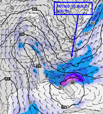
Last night's short term model depiction
BEYOND: Winds becoming more westerly in the next couple of days with a few periods of increased cloud coverage as two moisture bands rotate around the much larger parent low which was near Arkansas. This low will drop south and east in the next two days making for strong winds from around 7000 feet overhead and higher up, but which as it appears now will pass unrealized at the ground but for cloud coverage at time making for cooler afternoon highs  and very cool mornings commencing tomorrow morning (Sunday) due in part to west winds as opposed to easterly mornings winds coming in off warmer waters.

Gradual warming noted first on Wednesday afternoon with only a slight chance of showers toward the St John's river valley Basin and perhaps a stray shower on the North side of the Lake Okeechobee shadow in St Lucie or Indian River County toward the coast.

Will be watching for increasing tropical moisture though as a vast sprawling high pressure area over the Atlantic could bring increasing tropical moisture into the state prior to next weekend and beyond which will begin to interact with the next cold front that will only very slowly approach the state after triggering rains and storms across parts of Texas and NNE-NE along the stretch of the front which might get hung up over the South Central Plains region. The next better chance of rains so far is not until sometime around Friday and Saturday when we  could see showers and thunder over the interior counties and near the Lake, but even that will depend on if high pressure in the mid levels gets centered over or near the state which would shut down that possibility.  

So far beginning Wednesday it looks fairly certain that near summer like weather could be in the making temperature and moisture wise or seemingly so for those near the beaches, with only afternoon highs and greater moisture being constrained for a time.

No comments: